
National land source information is both an important evidence for enacting national economy development plans and making macroscopic decisions and a vital demand for the sustainable development of the nation. The UAV aerial platform has outstanding advantages in land source investigation for its low cost, low speed, long cruising range and high reliability. Operators can conveniently control the flight path and attitude of the aircraft while the UAV is performing a low attitude flight task

Law enforcement of national land source
The UAV remote sensing monitoring system can also provide services for the law enforcement and monitoring for the national land source. By the monitoring of UAV, delinquency in national land source aspect can be investigated and punished timely.
Fore-casting and warning of natural disasters
By carrying visible light gimbal, the UAV can estimate natural disasters like soil erosion degree, surface subsidence range, ground fissure length, landslides and debris flow locations, etc. The real time high-resolution images and videos provide important information for disasters
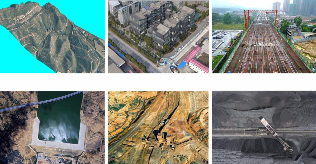
Investigation of mineral resource exploitation
UAVs can detect the exploitation site, exploitation state, mineral type, exploitation style, covering area, land type, solid waste stacking area, occupied land type, etc. They can also observe the disasters caused by mineral resource exploitation, including ground subsidence area, ground fissure length, collapse pit location, landslides and debris flow locations, channel filling length, coalfield spontaneous combustion area and so on.
Archaeology investigation
Through aerial observation and photographic from various angles and time periods and by using signs like topographic form, object shadow, flood, frost snow, soil humidity, vegetation, etc., some features of the underground ruins can be revealed by UAVs.